
Saturday 8 May 2010
Sunday 2 May 2010

Wednesday 21 April 2010

Saturday 17 April 2010
Dry Drayton and Childerley

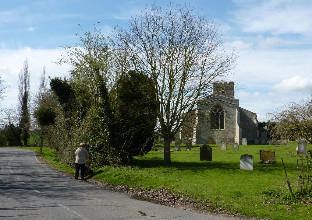
Take the Madingley Road, to the left of the church, for just a couple of hundred meters and round a bend to your left before finding a bridle path across fields and down the side of a wood, going south. After a while the path takes you over a foot bridge and into the adjacent field on your left, continuing in the same direction. At the end of the field that has been on your right, take the path back over the stream and head towards Scotland Road, going west. As you come near the road, turn left to follow the edge of the field inside the hedge next to the road until you find a V-style through the hedge. Cross the road and take the path heading across the field going west. You will climb gently to a ridge and then back down to a couple of trees in the middle of the field. Here you join the Pathfinder Long distance Walk. Follow this going west up to the top of the hill, through to the next field turn left, then to the right following the edge of the field down to some woods. Going through the woods, still following the marked path, takes you along an ash track to Childerley.
Childerley is a working farm, mostly wheat these days, with a fascinating Elizabethan house, where Charles I was once held under house arrest. As a separate parish, Sunday services are still held in the chapel; adjacent are the gardens with some fine topiary and a lake. On your approach you will have seen one of the longest timber-framed barns in England, sadly now derelict.
In the village, turn right towards the new barn (grain store) and before you get to it and opposite some old chicken houses, take the bridle path through the field where they have their remaining cattle (not so convenient if you have a dog with you). This path used to go through the wood to the left, but that is marked private. At the end of the cattle field, you will start along a glorious avenue going north north east, toward Lolworth. Where the avenue ends turn right down the side of a ditch dipping gently and rising again. Passing through some trees, now turn right (south west) towards the electric pylons. About halfway to reaching them turn left across the field on a marked path towards Rectory Farm nestled below. The path takes you to the right of the farm, where chickens and partridges run free. Just past the farm and on the road, turn left to take a bridge over a stream and then the path through the middle of the field rising to the edge of Dry Drayton. A narrow footpath takes you back to Scotland Road, between the gardens of houses. At the road, turn left back to the centre of Dry Drayton where the black horse awaits you with refreshments.


Sunday 28 March 2010

Sunday 21 March 2010
Waterbeach and Botisham Lock

Park in Waterbeach and follow the road south east towards the station past an interesting array of village cottages. You can follow the original path which veers off to the left before you reach the station, but you will be directed back to the level crossing along the station platform in any case. Immediately after crossing the railway take the path to the left down to a white "British Rail" style gate. Follow the path turning right towards the river, being careful not to stray into the Cam Sailing Club. Once at the river, walk on the embankment all the way to Botisham Lock.
Cross the river at the lock and follow the path along the east bank down to the bridge at Clayhithe; you will find a pub of that name there, good for meals at almost any time. Opposite the pub, on the other side of the road you can join a cycle track/footpath that takes you back to the station car park, and thence back to Waterbeach. (4.55 km)


Saturday 20 March 2010
Mere Way and Oldfield Farm, Landbeach

(6.6 km) You can park on the junction of Mere Way and where Milton Road coming out of Impington becomes Butt Lane leading toward Milton. Walk north east along the wide grass path that is Mere Way (once a Roman road from London to Ely called Akeman Street), you will see either side soft fruit growing in poly-tunnels. Proceed until you see the sign to the conservation walk on your left. Follow the edge of the field, then over footbridge. Keep following the path through a series of newly planted woods and field edges. At one point you will cross a track leading to some farm buildings and you can find the information on Oldfield Farm and the plantation of this wood in 1991. At the far north east of the Oldfield Farm development you will need to double back along the edge of a field, going north west, to join a track running north. Where you meet another track, turn right to walk south east towards Rectory Farm, a newly converted thatched barn. Just before you reach the barn, pass through the hedge on your left to joint the marked path and continue east until you are near the barn. Your route now takes you north east again, across very flat fen terrain. Turn again where you can cross the ditch to head east again towards a copse. In the wooded path turn south to find your way back onto Mere Way near the outskirts of Landbeach. Now head south along Mere Way, initially a made up road, to return to your car.


Sunday 7 March 2010
Earith Gravel Pits

Earith is a village about 12 miles north west of Cambridge. Drive out along the road in the north east of the village towards a small industrial estate, then park on the road going north and that leads to a fishery farm. Start your walk going north along this track. With glimpses of the water filled open cast gravel pits to your left, continue north on a stretch of made up road. A bridle path continues past the entrance to a farm and then bears left around further gravel pits. New workings to the north of the path are not shown on the map. The path take you round in a loop eventually meeting the made up road you encountered when going north. Turn left, along this road until you see a wide grass path, now going south and just before the gravel pit on your right. Follow this path, over a foot bridge at the end of the pit and then all the way back to Earith. When you see a small camp site, near a series of electric fenced enclosures, you can double back, with the camp site on your right, then across a field and pass between two of the gravel workings. Find your way back to the original track to complete the walk.


Sunday 28 February 2010
Boxworth and Knapwell

20 minutes from the centre of Cambridge by car; take the A14 going west to the Boxworth exit, park at the south western end of the village. To start the walk take the road going south, marked "No through road" where the main road through the village turns to the right. Follow this for just over 1 mile where you will see a footpath sign pointing in both directions. This is where part of the pathfinder long distance walk forms a crossroads. Turn right down the track towards Knapwell. We saw evidence of a Badgers set right next to this main path (see photo).Follow this pleasant track past wooded areas to your right and after just over half a mile, at a dip, take the path towards the Overhall Grove nature reserve. The path takes you through woods of the nature reserve with the stream on your left. When you get through the woods, and near a map of the reserve, you can take the bridge over the stream into the village of Knapwell or, to complete the walk, take the opposite direction on a path over open grass lands heading up a gentle incline and with woods either side. At the top of the hill cross the concrete road and follow the boundary between the two fields. A short grass track with new metal kissing gates either end then takes you back to the original road and back into Boxworth. On 28-2-10 after heavy rain the stream was very full and the path back into Knapwell not passable without waders.


Subscribe to:
Posts (Atom)
